• Don't miss out on all the fun! Register on our forums to post and have added features! Membership levels include a FREE membership tier.

COOKE IN APRIL

R

roni87

Well-known member
Feb 11, 2011
513
213
43
I Falls, MN
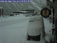
Not as much new snow as they were calling for. Only about an inch or two. Found softer snow the higher we went yesterday, looks like another sunny day in cooke today
 

jmom

Well-known member
Lifetime Membership
Feb 5, 2009
278
183
43
Is anybody renting sleds in Cooke still?

Bear Claw Bob, bearclaw sales and service Call the Super 8 to inquire as Bob is out of town this week.

It is still good at this point. The Miller trail out of the back of town is getting thin fast though. Haven't been up the other passes/trails yet. The hills still have a good amount of base on them for riding. The challenge is going to be getting there. The 'top' is not an option from here in Cooke. 212 coming in from Pilot Parking Lot is pretty well hit too. The pavement is showing and bare in quite a few spots.

Yesterdays avalanche report was low so some climbing was in order.

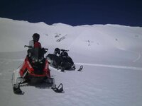
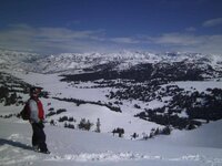
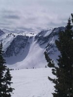
We had a phenomenal day poking around the hills and highmarking, one of the best all season even with the limited snow. We were lucky enough to have a 2-3 inch freshen up on top to make everything look good. Maybe it was the 'Hero' effect but what a day of spring riding, spiking the adrenaline with big climbs.

Avalanche.org Report

Mountain Weather:

Yesterday was sunny, but mountain temperatures only reached into the mid-30s. Under clear skies this morning temperatures are in the high teens as winds blow 10-20 mph out of the southwest. Today will be sunny with temperatures reaching the 50s as winds remain light. Tonight looks to be clear and cold again with more sunshine on Wednesday. In the valleys I’m forecasting balmy temps in the 60s along with sightings of flip-flops, shorts and pasty white legs.
Snowpack and Avalanche Discussion:

The Bridger, Gallatin and Madison Ranges, the Lionhead area near West Yellowstone and mountains around Cooke City:

Southwest Montana is going to get hit with a big storm this morning--a solar storm. The sun will be out in full spring glory with mountain temperatures easily reaching into 50s. Last night’s sub-freezing temperatures will ward off melting for a few hours, but melting is inevitable. Wet, loose snow avalanches will occur naturally on steep, sunny slopes. A thick ice crust underneath Monday morning’s new snow is a great sliding surface, but this will likely turn to mush by mid-afternoon too. Pinwheels growing in size as they roll downhill or sinking past your boot tops into wet, unsupportable snow are signs the surface snow is rapidly losing strength. Today, there are two avalanche concerns.

1. Wet, loose avalanches on any slope getting sun exposure.

2. As these wet slides slurry downhill they gain mass and could trigger a slab avalanche (both wet or dry). These avalanches would be deep since the weakest layer is large facets near the ground.

The mountains from West Yellowstone to Big Sky to the Bridger Range have deep slab instability. The entire winter’s snowpack is being supported by junk. I dug to the ground at Lionhead and found fist hardness facets trying to hold up a six foot thick pencil hardness slab (photo). Triggering a slope will require either a large load like a wet loose avalanche, or riding over a thinner spot where we could initiate a fracture in the facets. Any slab avalanche would be large and nasty. Additionally, on slopes that get direct solar radiation the snow is likely moist under the surface crusts. A moist snowpack is weaker than a dry one because frozen bonds are replaced by liquid water.

The avalanche danger today will start out as MODERATE on all slopes, but quickly rise to CONSIDERABLE on slopes getting direct sun. Wet, loose snow avalanches may appear harmless, but they can quickly carry you into terrain traps or off cliffs. And if they trigger a slab avalanche, well, all bets are off.

Outside Cooke City the probability of wet, loose avalanches will mirror the other areas. New snow from Monday is sitting on an ice crust and today these mountains will get their share of sun and above freezing temperatures. However, most slopes lack depth hoar which lessens the chance of finding any deep slab instability.
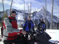
3-amigos,-over-look.jpg high-marks.jpg more-marks.jpg Rev-Kev,-Looking-at-the-bas.jpg
 

goridedoo

Well-known member
Premium Member
Feb 8, 2010
3,868
3,544
113
Anyone from south dakota heading up to cooke this weekend. Looking to leave on Thursday and ride friday, saturday, and sunday.
Headed out from Arlington either wednesday night or thursday.
 

TRS

Life Member
Lifetime Membership
Dec 1, 2007
4,130
6,291
113
67
Cody, WY
Beartooth was pretty good yesterday afternoon. About an inch of new and the underlying snow was soft. Below Beartooth Lake the snow was rotten in spots(fall through to the bottom), be careful.
 
R

rollcontrol

Member
Sep 13, 2008
116
22
18
Stillwater, Mn
yeah, I checked with the Super 8 and heard Bob would be gone 'til this weekend. We'll see I guess looking to get up there weekend after next. NOAA looks promising!
 

goridedoo

Well-known member
Premium Member
Feb 8, 2010
3,868
3,544
113
What elevation do you mostly ride at in Cooke? should I be clutching for 8000-10000 or 10000-12000?
 
T
Jan 9, 2009
180
57
28
46
Well, I cant say I am dissapointed from all this. But gonna make the 1,200 mile trip either way and have a good time none the less. Leaving Saturday for a week. Worst case i come hoome with a good tan. Or look like lobster!:sun::sun:
 

goridedoo

Well-known member
Premium Member
Feb 8, 2010
3,868
3,544
113
I would say there is 16-18" of new in the high country. And a little more on the way. Tomorrow will be awesome if the sun peeks out. Sunday WILL be awesome.
 

jmom

Well-known member
Lifetime Membership
Feb 5, 2009
278
183
43
Well, I cant say I am dissapointed from all this. But gonna make the 1,200 mile trip either way and have a good time none the less.

The internet was down last week, I will post pictures from last weeks adventure on Monday.

Looks like you have lucked out......2 Feet of fresh in Cooke on the SNOTEL.

The snotel on Top of the World is not showing any reading....must be a ton, everyone should head over and rip that place up while its good.

http://www.snowestonline.com/forum/attachment.php?attachmentid=173542&stc=1&d=1333810164

The fresh snow has increased the avalanche danger. Ride safe out there.
Report from Avalanche.Org
Yesterday it snowed a lot, temperatures dropped, and winds were relatively calm. Since yesterday morning, the mountains near West Yellowstone received 27 inches of snow, near Cooke City 15 inches, near Big Sky and Bozeman 10 inches. There must have been a donut hole in the storm over the southern Madison Range and the Taylor Fork area which only received 3 inches of snow. This morning temperatures dropped into the low teens F and winds were blowing 10 mph from the W with gusts of 15 mph. Skies were clearing this morning and today will be a mix of sun and clouds. Temperatures will rise into the mid to high 20s F. Winds will blow from the W and SW and increase this afternoon blowing 10-15 mph with gusts of 25 mph.
Snowpack and Avalanche Discussion:

The Bridger, northern Gallatin and northern Madison Ranges, the Lionhead area near West Yellowstone and the mountains around Cooke City:

In the last 48 hours the following snowfall and SWE amounts were recorded:

Fisher Creek SNOTEL near Cooke City – 26 inches of snow (2 inches SWE)
Madison Plateau SNOTEL near West Yellowstone – 28 inches of snow (1.9 inches SWE)
Bridger Bowl – 15 inches of snow (1.7 inches SWE)
Moonlight Basin near Big Sky – 16 inches of snow (0.9 inches SWE)
Shower Falls SNOTEL in the northern Gallatin Range – 14 inches of snow (1.2 inches SWE)

In most places this snow fell on a thick melt-freeze crust and easily slid. The Bridger Bowl Ski Patrol found pockets of wind deposited snow in odd places after E winds yesterday morning. This wind deposited snow readily produced avalanches. Near Cooke City a skier triggered a soft slab avalanche 12-14 inches deep from 100 feet away (photo), and Cooke City Motorsports reported a natural avalanche on one of the steep slopes above the unplowed section of Route 212. With so much new snow, avalanches should be easy to trigger today.

There are two weather factors that will potentially increase the avalanche danger. Any increased winds will easily transport the new snow which has a very low density of 5-6%. Also, clear skies and strong sunshine in some areas may warm the new snow close to its melting temperature and trigger avalanches in the new snow.

Another avalanche concern that should be in the back of your mind is weak snow near the ground (photo). This weak snow exists in the mountains near Bozeman, Big Sky, and West Yellowstone on all aspects. It produced large dry slab avalanches 18 days ago and large wet snow avalanches 11 days ago. Triggering an avalanche on this layer will not be easy, but the consequences would be severe. Near Cooke City, the snowpack is much deeper and stronger making this problem much less of a concern. Today the avalanche danger is rated CONSIDERABLE.

bearclaw.jpg
 
Premium Features